

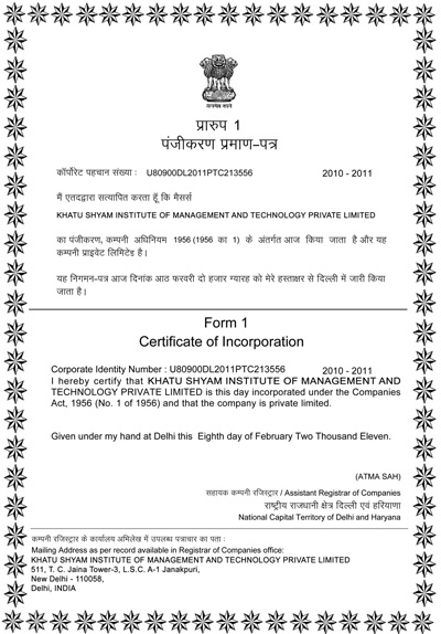
 National Registrar Ministry of Corporate (Govt. of India).
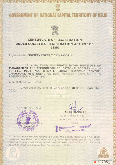 Registrar By NCT, Govt. of Delhi.
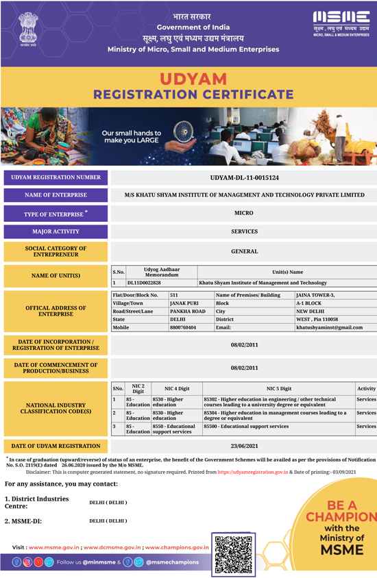 Register By Ministry of MSME, Govt. of India
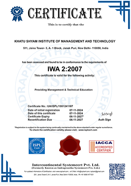 WA 2:2007 Certified By Indraprastha SystemCert Pvt.Ltd is Accredited By Integrated Accreditation Centre For Certification (IACCA) http://www.www.iacca.in
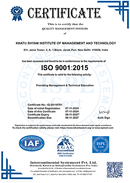 An ISO 9001-2015 Certified By Indraprastha SystemCert Pvt.Ltd is Accredited By Emirates International Accreditation Center (EIAC) https://www.eiac.gov.ae
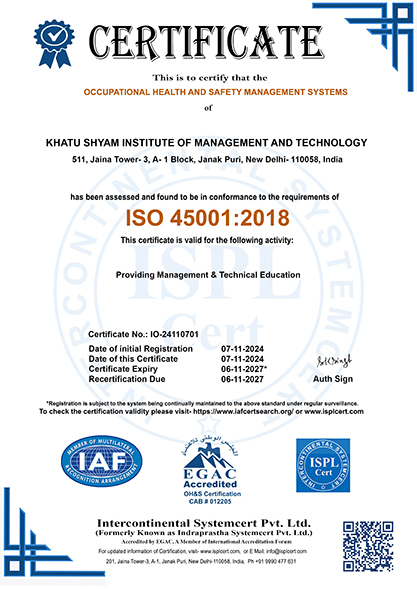 An ISO 45001:2018 Certified By Innovative SystemCert Pvt.Ltd is Accredited By Egyptian Accreditation Council, (EGAC) http://www.egac.gov.eg
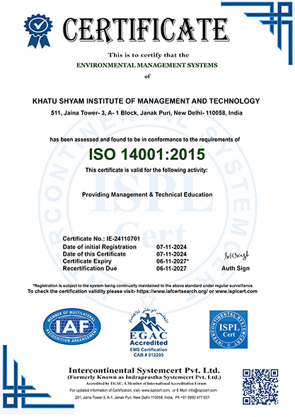 An ISO 14001:2015 Certified By Innovative SystemCert Pvt.Ltd is Accredited By Egyptian Accreditation Council, (EGAC) http://www.egac.gov.eg
Master Program in Business Administration (Geoinformatics and Remote Sensing Management)
Lead Spatial Innovation with an MBA in Geoinformatics and Remote Sensing Management
The Master Program in Business Administration (Geoinformatics and Remote Sensing Management) at Khatu Shyam Institute of Management & Technology (KSIMT) is a fully theoretical, work-integrated distance learning program. Designed for professionals in geospatial sciences, urban planning, and environmental management, this program focuses on geoinformatics business strategy, remote sensing applications, data management, and spatial project leadership—without requiring any software training, field surveys, or technical assignments.
Program Highlights
-
100% Distance Learning – Study flexibly from anywhere in the world
-
Fully Theoretical Curriculum – No GIS software handling, field surveys, or practicals
-
Perfect for Urban Planners, Environmental Consultants, and Geospatial Analysts
-
ISO Certified | Operates under Government of Delhi & Government of India Guidelines
-
Open for Students Across India and Abroad (UAE, Dubai, Qatar, Oman, Kuwait, Saudi Arabia, Bahrain)
Who Should Enroll?
This program is ideal for:
-
Professionals in urban planning, infrastructure development, and environmental management
-
Entrepreneurs launching geospatial consulting businesses
-
Project managers dealing with remote sensing and satellite data
-
GIS analysts seeking business management roles
-
Graduates aiming to work in geospatial technology and data strategy
Career Opportunities After MBA in Geoinformatics and Remote Sensing Management
Graduates from this program can pursue roles such as:
-
Geospatial Business Manager
-
Remote Sensing Project Consultant
-
GIS Project Coordinator
-
Urban Infrastructure Planning Manager
-
Spatial Data Strategy Consultant
-
Environmental Risk and Planning Advisor
Why Choose KSIMT for Your MBA in Geoinformatics and Remote Sensing Management?
-
100% theoretical, work-integrated program ideal for busy professionals
-
Work experience recognized as part of your academic learning
-
Curriculum aligned with global developments in GIS, geospatial science, and remote sensing
-
Affordable and flexible online correspondence education
-
Trusted by geospatial and environmental professionals across India and internationally
Build Expertise in Geospatial Business Leadership
Join KSIMT’s MBA in Geoinformatics and Remote Sensing Management and drive spatial innovation and sustainable development through flexible distance education.
Course Offered By : KSIMT under autonomous mode through distance education
Request a Callback
Admission Guidance for Working Professionals Work experience preferred (3+ years recommended)